Year of Publication:
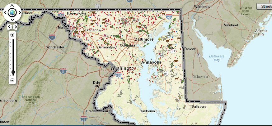
What does a food system look like? How are various entities connected? Where are there gaps in the system? What does a food desert look like?
The Maryland Food Systems Map, a project of The Johns Hopkins Center for a Livable Future seeks to answers these and many other questions. This interactive resource maps the many components of Maryland's food system from local farms to grocery stores, layered with land use, health, demographic and social services data. Users are able to explore what is most interesting to them or to view the food system by neighborhood, city, or state. Data from a vast range of sources have been compiled into this "collective resource" and are continuously updated through collaborations with students, organizational partners, and government agencies.